スタヴァンゲル地図 | 日本語
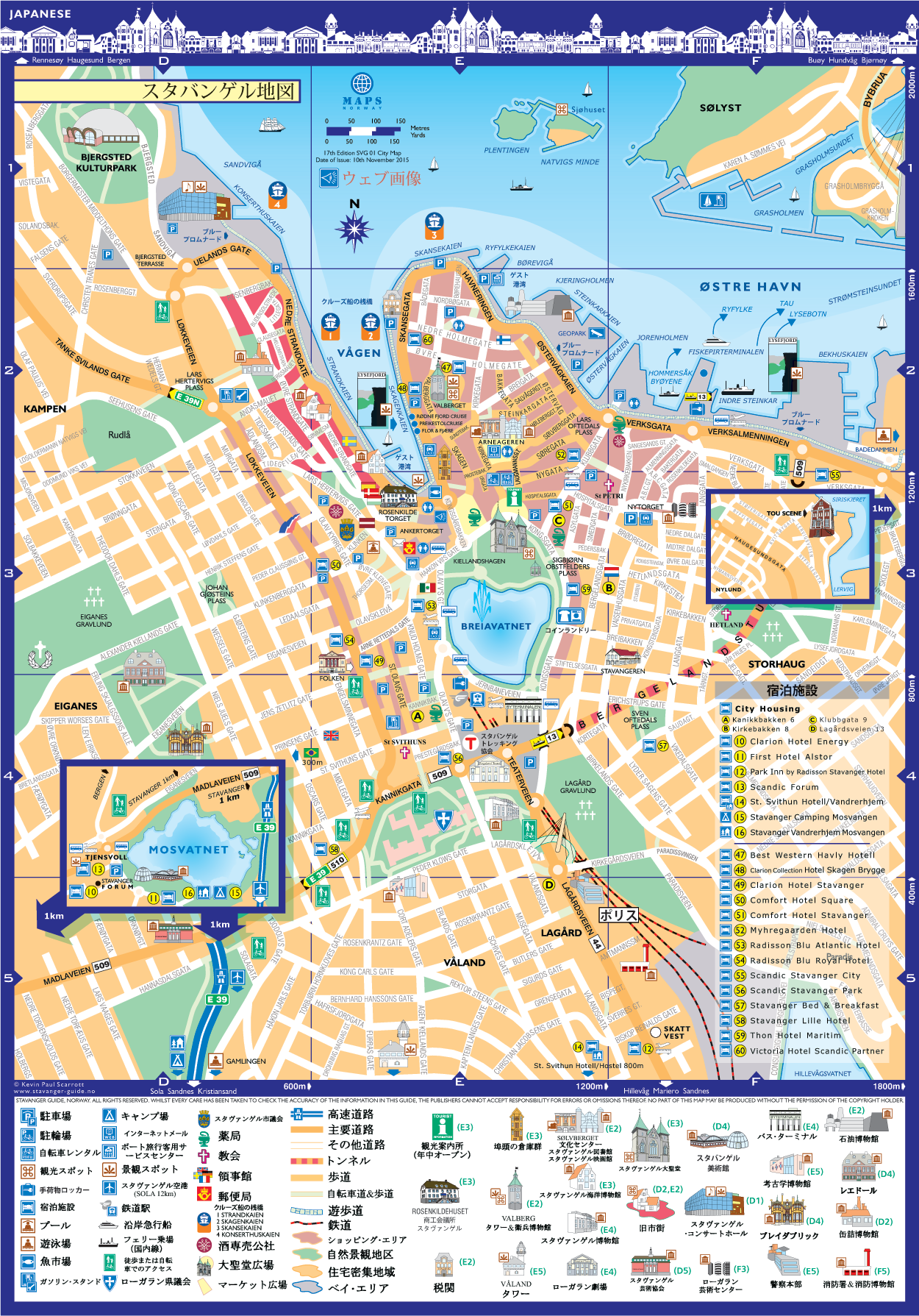
スタヴァンゲル市内地図
PDF形式でマップをダウンロードするには画像をクリックしてください。
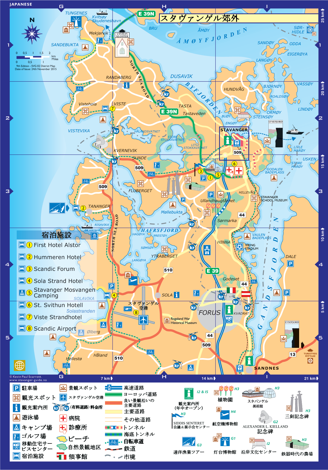
スタヴァンゲル及び区域スタヴァンゲル周辺とその周辺
PDF形式でマップをダウンロードするには画像をクリックしてください。
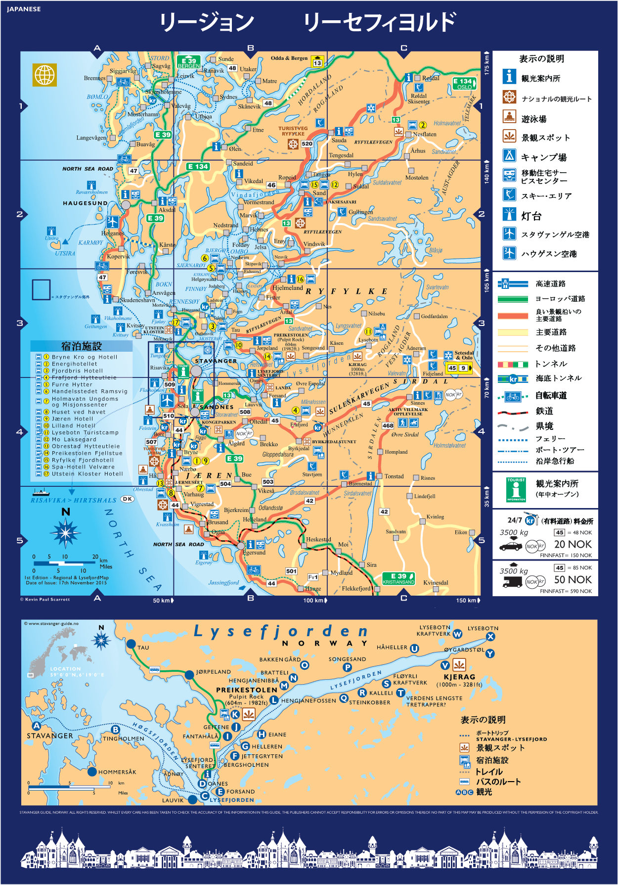
リージョン
PDF形式でマップをダウンロードするには画像をクリックしてください。
し、スタヴァンゲルから
PDF形式でマップをダウンロードするには画像をクリックしてください。
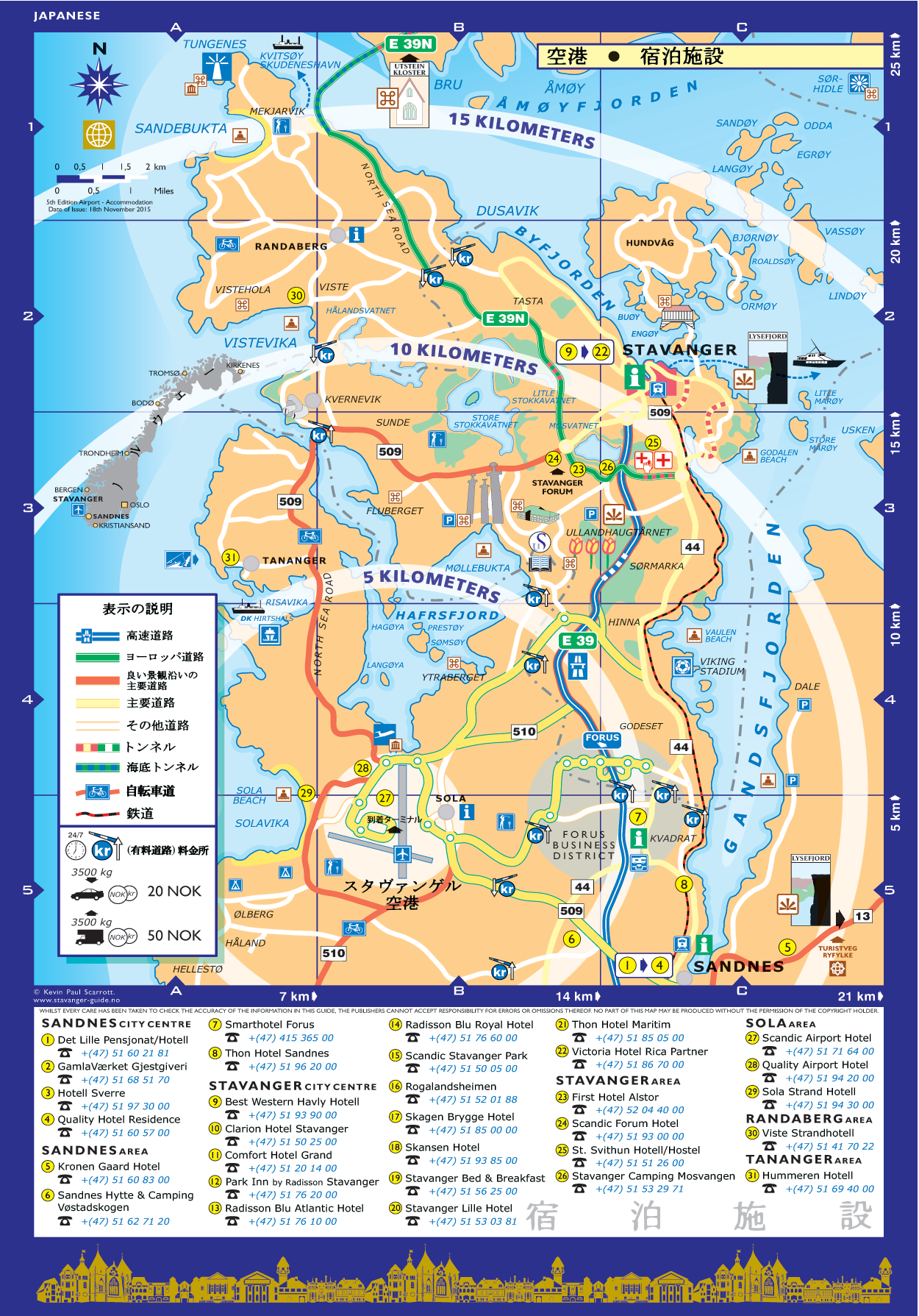
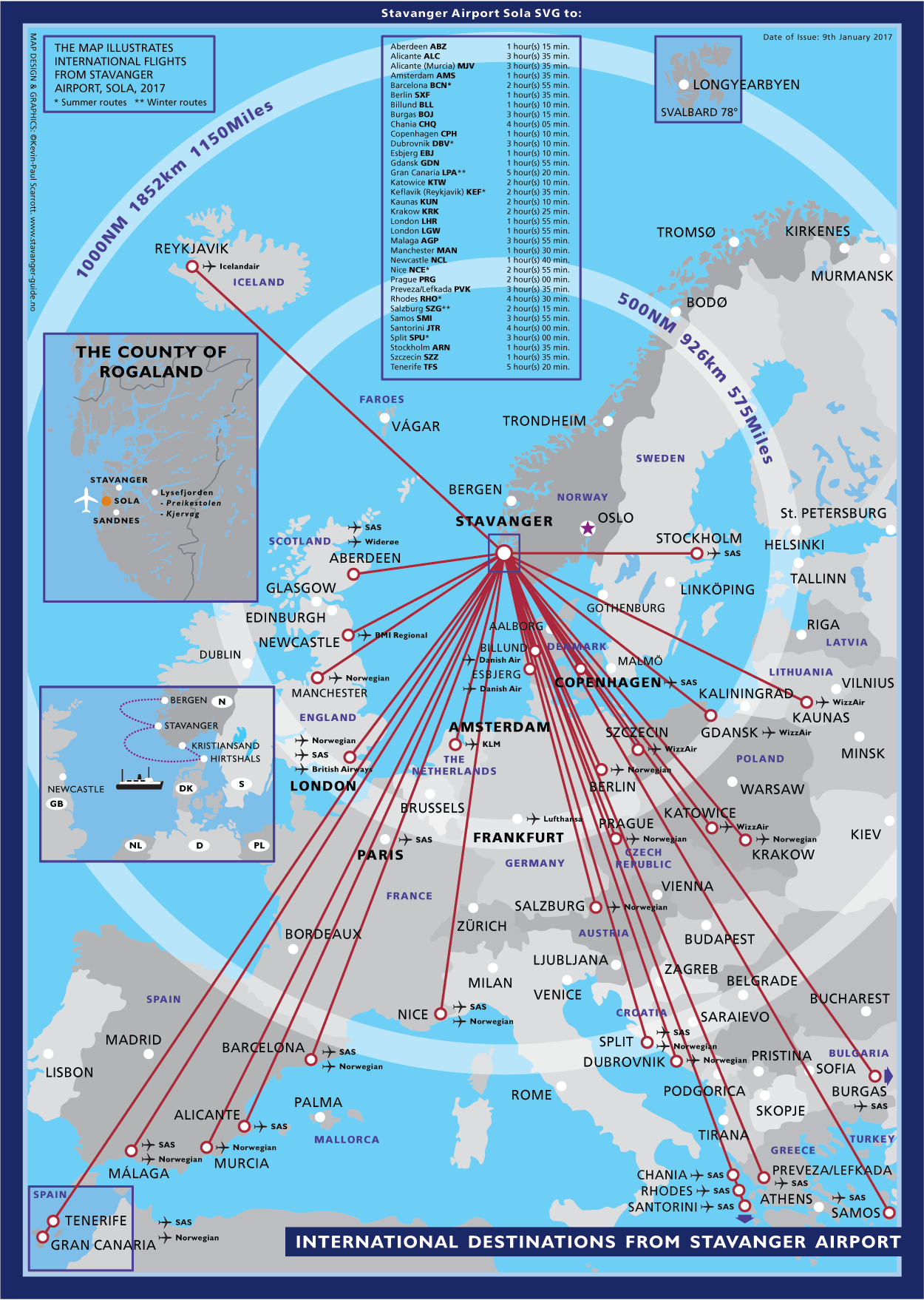
スタヴァンゲル-空港と宿泊施設
PDF形式でマップをダウンロードするには画像をクリックしてください。